Making Africa's farmland measurable, provable, and fundable.
GreenScope Innovations combines satellite data with targeted ground checks to measure soil, water, and land use at farm and landscape scale. We're proving it first in soil-carbon measurement for smallholder farms.
Credible carbon measurement, built for smallholder scale: about $0.30 per tonne CO₂e measured, versus $20–50 for conventional MRV. Deploys in 4–6 weeks.
Why credible measurement has been missing at scale.
High-resolution, defensible data on soil, water, and land use has been out of reach for smallholder geographies. That blocks proof, policy, finance, and payment, for carbon and beyond.
Too expensive
What conventional field-based MRV costs. Physical audits and consultant-led sampling price out programs that need thousands of farms.
Too slow
How long baseline-to-decision cycles take. Adoption and policy response collapse when evidence arrives this late.
No defensible proof
What happens to claims without defensible attribution. Buyers, regulators, and funds increasingly reject correlation dressed up as proof.
A verification stack in three layers.
Measurement, attribution, and intelligence, unified into one system built for tropical smallholder geographies.
Measurement
Satellites plus ground checksWe combine satellite imagery with select ground visits, and we're upfront about the uncertainty in every number we produce.
Attribution
What's really workingWe separate what better farming actually caused from rainfall, soil type, and normal seasonal swings, so the result holds up to scrutiny.
Intelligence
Ready-to-use resultsThe same results work for project developers, governments, and funds. One system, several uses.
Carbon first. Built for more.
Carbon is where we're earning revenue today. The same system is built to measure water and biodiversity next.
Soil-carbon measurement
Measurement good enough to issue and sell carbon credits. This is where GreenScope is earning revenue today.
Policy & reporting
Data for governments and regional bodies on climate, water, and land-use planning.
Water funds
The same system applied to payments for water conservation.
Biodiversity
One system that measures soil, water, and biodiversity together.
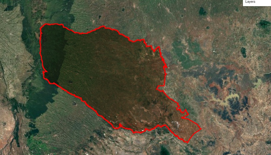
Murang'a County, Kenya. The first deployment.
Phase 1 ran on public satellite data in under six weeks, as the first real deployment of the platform, mapping 92,329 hectares of net agricultural area across seven sub-counties. The same pipeline deploys to any tropical agricultural county in 4–6 weeks.
GreenScope Innovations is in active engagement with project developers, government bodies, and continental institutions across the region.
| Sub-county | tCO₂e | Zone A | Action |
|---|---|---|---|
| Kangema | 9.1M | 47.5% | Invest |
| Kigumo | 7.2M | 41.3% | Invest |
| Gatanga | 7.3M | 28.6% | Invest |
| Kandara | 4.0M | 11.4% | Monitor |
| Mathioya | 5.7M | 8.5% | Monitor |
| Kiharu | 5.4M | 5.0% | Monitor |
| Maragwa | 4.4M | 2.4% | Monitor |
Defensible measurement for everyone who needs proof.
We work with actors who need defensible agroecological measurement, starting with carbon and extending to water and land use.
Project Developers
Get measurement done for a fraction of the usual cost, in a format that fits your verification process.
Request a demo→Governments
County and national data for climate, water, and land-use planning and NDC reporting. Decision-ready, not just dashboard-ready.
Explore a pilot→Climate Funds
Evidence to support investment decisions across carbon and ecosystem-service programs.
Request data access→Registries & Verifiers
Results designed to align with BCR AFOLU, Verra VM0042, and Article 6 standards.
Discuss alignment→Watch what we built.
Let's talk about your program.
Developers, governments, funds, and standards bodies: tell us what you're working on. Not sure where you fit? Just tell us what you're working on.
- i. Request a demo of the dMRV platform and carbon intelligence outputs
- ii. Explore piloting the platform in your geography or project portfolio
- iii. Engage GreenScope for methodology co-development or registry alignment
- iv. Discuss strategic partnership or platform integration opportunities